
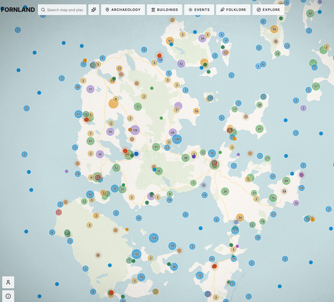
This is a modified version that the developer Thor has sent to us. It enables the user to see what structures were in use and visible at any particular time. The data for this is incomplete so for now just enjoy this very Beta version. When we can get more date information about the items then this will be reflected on the map. Please feel free to send us any comments and thoughts. The data comes from various sources.
From the developer:
“My name is Thor Martin and I live in Oslo. Over the past couple of years I have built Fornland, a map of archaeological sites and protected buildings across the Nordic countries, the Baltic states and the British Isles. Around 1.8 million records from 19 national registers sit on the same map, so you can see what is in a landscape without working through five separate databases.
The Scottish material comes from Historic Environment Scotland, so scheduled monuments and listed buildings across Orkney are on there. What made me build the thing in the first place is the view you get when Orkney sits next to Norway and the Faroes on one screen rather than in three separate systems. Brochs, chambered cairns and Norse settlement start to look like one distribution.
The map is free and carries no advertising, and nobody needs an account. It works on a phone, so it is meant to be opened while you are standing in a field. I thought it might be useful to your members. Do pass it on if you like it.
Drag the year and the pins change. A site that is not built yet shows as a hollow ring and one that has been abandoned turns grey. Thirteen records in the West Mainland have dates of their own (twelve sites, Barnhouse has two). I took them from the HES statements of significance, Canmore and the excavation reports, and three of the standing stones are only dated by the monument next to them. So the Stones of Stenness come before the Ring, and Barnhouse is gone by 2900 BC. Everything else falls back on the period its register gives, which is only good to within an era.
The timeline bar now has a tick box next to “Not yet built”, and if you untick it the empty circles go away, so the map only shows what stood at the year you have picked.
The dates are my reading of published summaries, and I would not be surprised if an archaeologist moved some of them. If someone sends me a site, a start year, an end year and where the dates come from, it goes in as it is, and the source is printed in the site’s panel.
I am also going to deposit the table on Zenodo so that it has a DOI and everyone who adds dates is named as an author. That might make it easier to ask people for their time
I would be glad to hear from you if you spot mistakes.
Best wishes
Thor Martin Bærug”